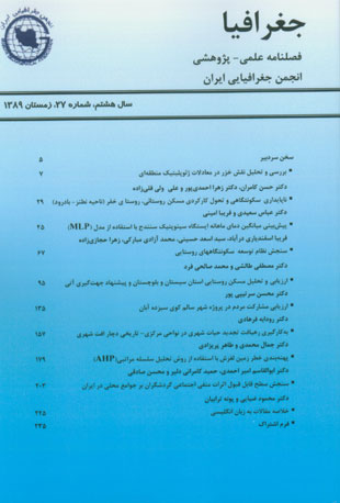
فهرست مطالب

فصلنامه جغرافیا
پیاپی 27 (زمستان 1389)
- 236 صفحه،
- تاریخ انتشار: 1389/11/20
- تعداد عناوین: 10
-
-
صفحه 5
-
ناپایداری سکونت گاهی و تحول کارکردی مسکن روستائی / مورد: روستای خفر (ناحیه نطنز- بادرود)صفحه 29
-
به کارگیری رهیافت تجدید حیات شهری در نواحی مرکزی- تاریخی دچار افت شهری / نمونه موردی: ناحیه مرکزی، تاریخی شهر قزوینصفحه 159
-
پهنه بندی خطر زمین لغزش با استفاده از روش تحلیل سلسله مراتبی / مطالعه موردی حوضه آبخیز چلالاو آملصفحه 181
-
سنجش سطح قابل قبول اثرات منفی اجتماعی گردشگران بر جوامع محلی در ایران / مورد مطالعه سکونتگاه های روستایی حوزه ی تالاب پریشانصفحه 205
-
Settlement Unsustainability and Functional Changes of Rural Houses / The Case of Khafr Village (Natanz- Badrud Area)Page 29The recent socio-economic changing processes, besides changing patterns of migration have led to sustainable/unsustainable processes and physical-spatial transformation of rural settlements. In this regard, rural-urban migration and leaving some buildings in thecountryside led to functional changes in using the spaces within some rural dwellings. This article tries to examine the different dimensions of these changes, and moreover, how rural unsustainability leads to some different land-use and thus, accelerates the undurable situation of the whole settlement.
-
Page 45Prediction of temperature as one of the most important climate parameters in different management areas and natural water resources, droughts, environmental studies, flood risk, food shortages, development of pests and diseases, transportation and etc., of special importance in determine future policy for the optimization of resources and spending costs, control and prevent crisis and has use of resources. In this study,through information monthly average temperature of Sanandaj Synoptic Stations in 38-year statistical period (2001-1964), as input Multilayer Perceptron network, the monthly average temperature was predicted during the years (2005-2002) to determine error model. For this purpose, used the features and functions available in environment programming MATLAB software, advantage was taken. Then the performanceevaluation model by statistical criteria, including regression and correlation relationships between observed and predicted values of temperature and addressed the relative mean error percent. The results show good efficiency and acceptable accuracy of artificial neural networksin predicting the temperature. So that the correlation coefficient equal to0/99 and the mean percentage error of the model with 1/97 percent., ie prediction is Network true, the temperature difference of less than one degree Celsius temperature Therefore, using this method, temperature conditions can be defined beforehand, and involved water and natural resources management.
-
Page 95The villages need for suitable housing and desirable physical environment have accompanied expansive actions like preparing and implementing pilot plans and rural housing rehabilitation and renovation during some decades after the revolution. Thereforethrough 30 years after the revolution, 18469 rural pilot plans have prepared and implemented and until the end of 2008 about 1700000 residential units on villages have rehabilitated and renovated. By the end of 1387 about 620 pilot plan and 30000 residential units have been renovated and if the renovated units owing to disasters to be added to them, a considerable number would increase. Knowing the residentialunit component parts (materials and matters, structure, architectural spaces, beauty, function and…) are connected and interrelated ingredients that are forming housing through cooperation with each other and their relation and coordination could created desirable housing, are the basic principle which must consider on housing renovation and rehabilitation plans. This article is seeking to solve the existent problems on rural housing parts and ingredients of province and their politics with assumption to preservation the local patterns of province. The article has appraised with reliance on rural housingspecifications sampling plan, the rural housing situation on four fields include consistency conditions (security), privilege (comfort), economic-livelihood (livelihood operation and housing economical role) and environmental (environment coordination and housingsubsistence damages) and the recommendations according to the province conditions have introduced
-
Page 137The main object of Healthy Cities Project (HCP) is achieving to city health promotion for purpose of World Health Organization (WHO) Health for All (HFA) principles. This object could be possible with community participation and intersectional cooperation. Since in thispurpose is emphasized the community participation, the main question of this research is that to what extent succeeded the Healthy City Project in community participation attracting? Reaching this purpose, we examined the Confidence Limits of community participation, age, marriage, habitancy, job, sexuality and the level of literacy of samplesand their information about project activities as well its influences to self-help and participation level and its increase between 424 samples in Kooy-e-Sizdah-e-Aban. The results of this research show that the success rate of HCP in attracting of community satisfaction and participation in all fields such as sanitary, environmental, safety, andeducational activities are significantly upper than average. Also the results of this research show that there exist significant effects between participation level, literacy and job with people's satisfactions from HCP. And there exist significant effect between believe to importance of participation, acquaintance and satisfaction about activities, participation level and ages with people's readiness for participation to future plans of HCP. So in urban planning must seek to promotion of community participation. To reach this purpose it may be effective the attracting of community satisfaction and informing obout activities.
-
Page 159A city grows during the history, transforms and its shape changes based on economic and social affairs and natural factors. These changes have not been brought out with regular intensity and pace during the centuries, as if they have been the reflection of past andpresent culture during the history and are the evidence of different durations of life. A desirable city is the one which revitalizes the old and ancient urban contexts based on new requirements parallel with ongoing developments and new urban context and so during this process it makes a reasonable and constructive relation between oldand new contexts as though the urban integrity and identity are kept. In general, the urban context approves the history. Maintenance of the central and historical districts of a city without changes is neither possible nor sensible. So with holding multi-dimensional and strategic views, the challenge of urban planners is giving attention to the urbancore of a city within new-experienced approaches in the world which might be applicable in preventing known urban decline and offering more systematic approaches. This study attempts to identify the cause of urban decline in central-historical district of Qazvin and to apply the urban regeneration in the stream of urban decline and changereflection.
-
Page 181Among various regions of Iran, Northern areas are taken in account as a vast area having the most landslides. Due to population as well as natural situations is ready to awful fanatical and vital damages. Examining effective factor on occurrence of locally earthquakes and also zonation on lands of a region can be an effective measure forminimizing related damages for instant by moving population from the risky area. Regarding to this measure, zoning map should be prepared for those regions.The basic method applied through the present study includes field examining and preparing data layers based on existing maps and other sources, the effective factors in occurrence of earthquakes were examined and the most effective factors were determined as geology, soil examination, linear elements, slope, rainfall, land use andelevation. Results showed that the significance rate for geology, soil examination, linear elements, slope, rainfall, land application, and elevation are 0/4, 0/22, 0/16, 0/11, 0/045, and 0/045,and 0/002, respectively (defined scale between 0 to 10). Thus it can bedemonstrated that effect of geology on the region was more than other factors; soil examination, linear factor, slope, rainfall, land use and elevation, respectively.
-
Page 205Parishan wetland, one of the natural resources registered as a global biosphere reserve, attracts many visitors each year. The presence and activities of these visitors exert various positive and negative impacts on the region and it affects the lives of host communities in different ways. Considering the integral role of host communities in tourism planning and sustainable tourism development, understanding their attitudes towards tourists’ presence is essential. This paper aims to identify the adverse social impacts of tourists’ presence on the rural communities surrounding Parishan wetland. Since few studies havebeen done in Iran, on local communities’ perception of tourism impacts and the limit of its acceptable changes, this paper would also determine the limit of acceptable impacts using “Limit of Acceptable Changes” method. The required data is gathered by interviewing tourism experts and the local communities, based on a semi-structured questionnaire. The findings of this study show that the current level of most of thenegative social impacts of tourists’ presence and activities in the rural settlements surrounding Parishan wetland is beyond the acceptable limit. This indicates the necessity of keeping a balance between the number of visitors and the nature of their activities in order to achieve a sustainable ecotourism within the studied region


